
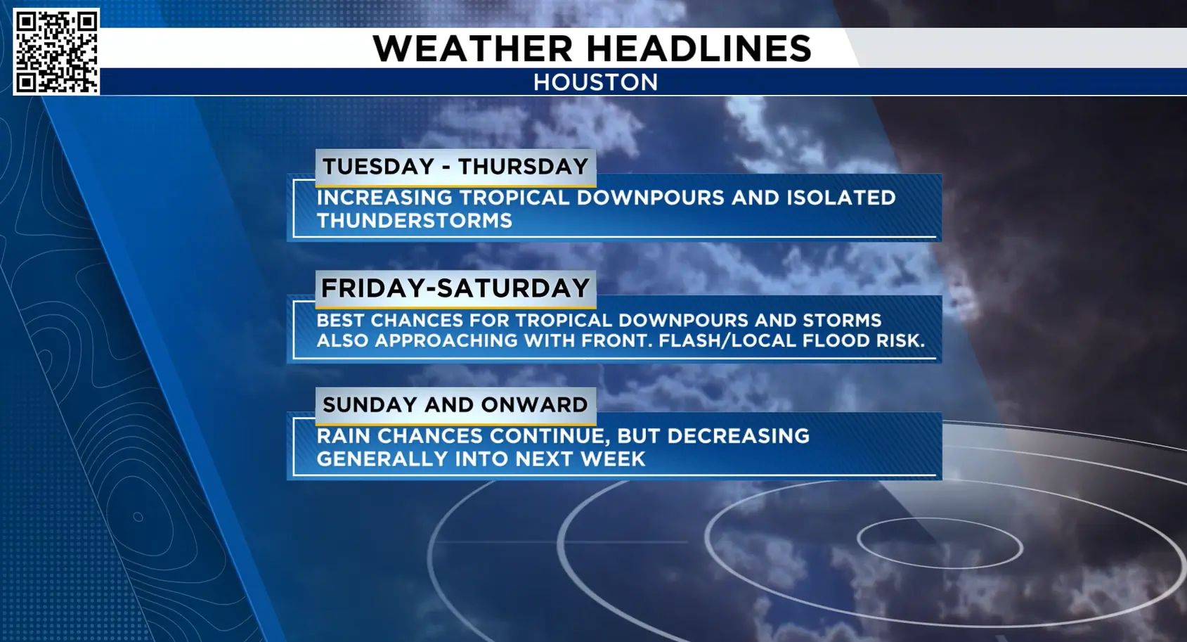
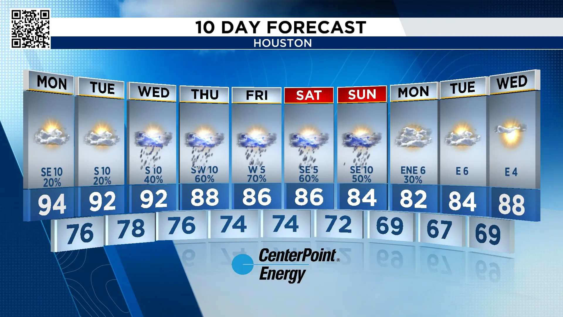
BOTTOM LINE: Not everyone will see the heavy, widespread rain, but most of us have a shot each day, starting Thursday and lasting into the weekend.
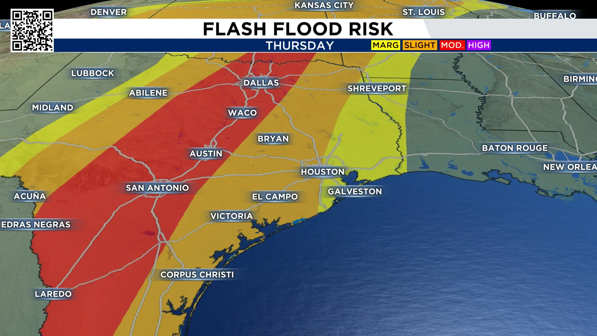
Moisture from Pacific Hurricane Polo gets pulled into Texas for the second half of the week, bringing scattered storms to the state and possible flooding, especially towards Central Texas.
Rain Chances:
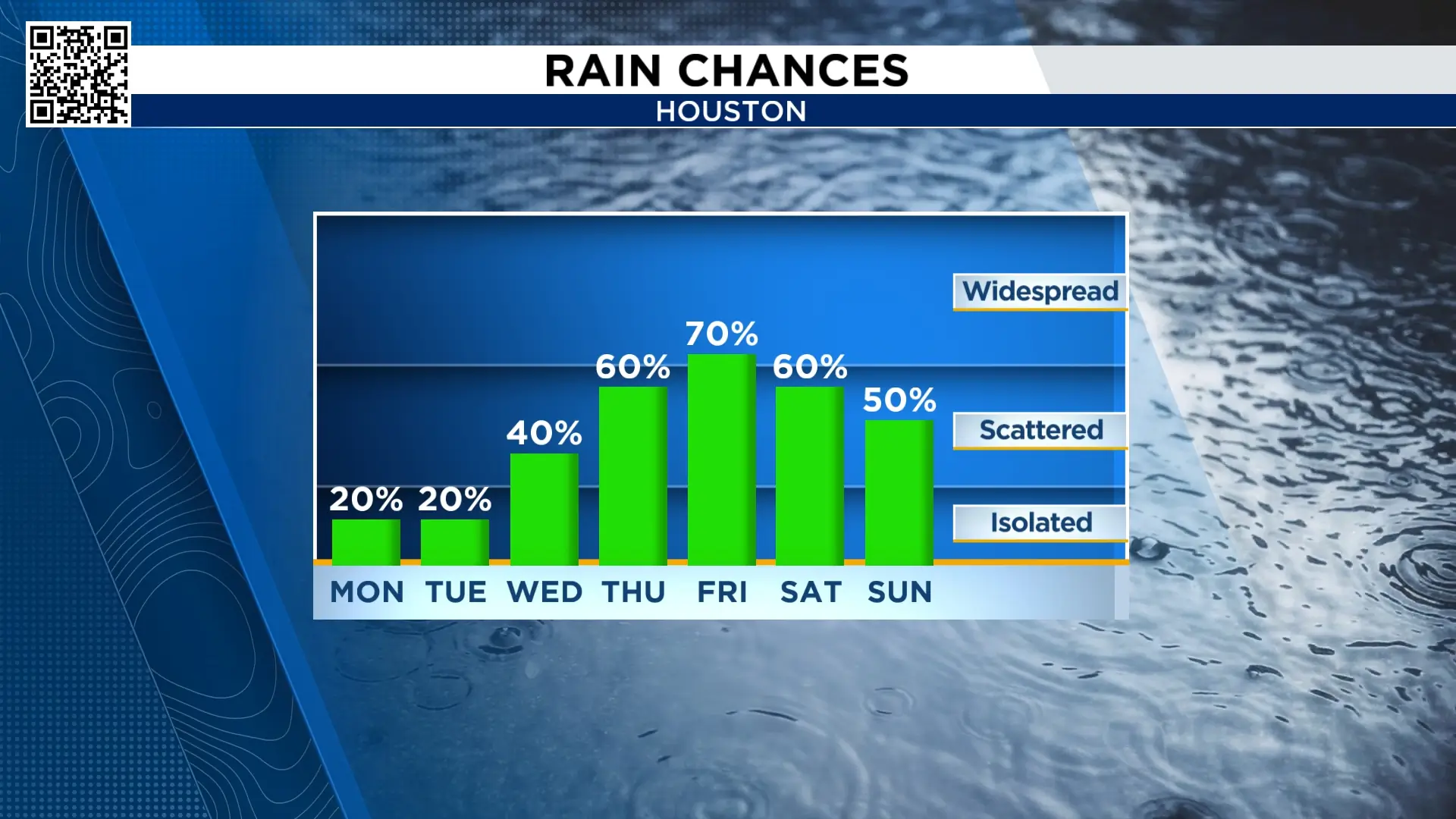
Rain chances at the start of the week are low. Isolated showers and storms are possible Tuesday, but most of us will stay dry.
The rain chances ramp up at the end of the week as tropical moisture gets pulled in from Hurricane Polo. At the same time, we’ll see a front moving in from the west, which will help to enhance the chance of seeing rain.
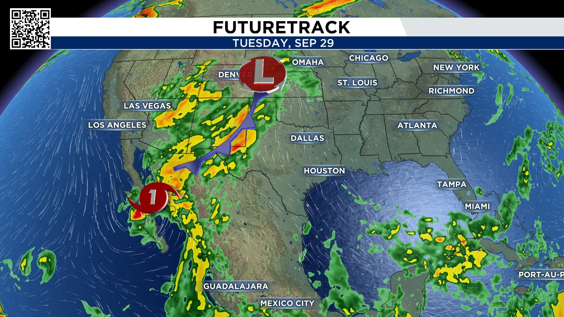
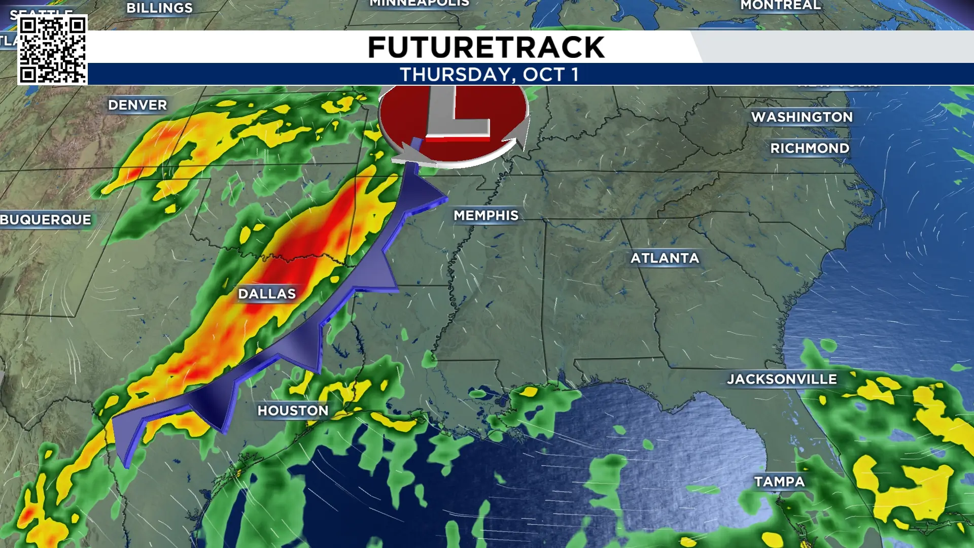
Right now, the highest rainfall totals are expected to stay to the west of Houston, but isolated spots in Southeast TX could see heavy rain, which could lead to a few instances of street flooding.
Tracking the tropics:
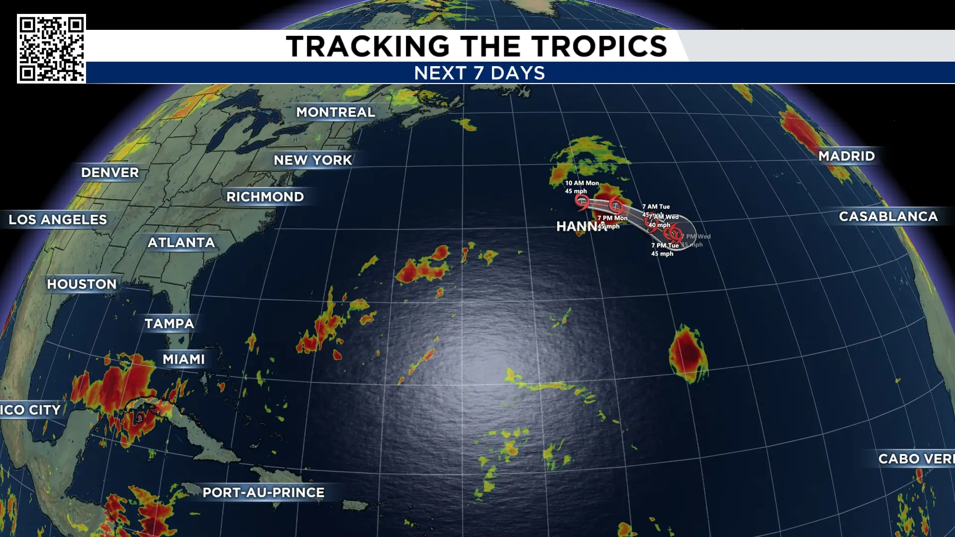
All is quiet in the Gulf. In the Central Atlantic, Tropical Storm Hanna has formed. Hanna is expected to be a fish storm meandering through the Atlantic until dissipating midweek.
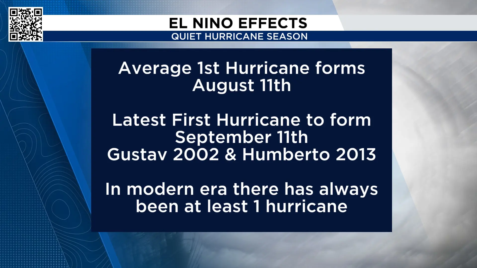
So far this hurricane season we’ve had eight tropical storms. We have not had a hurricane in the Atlantic basin. The latest first hurricane to form was Gustav and Humberto, which formed on September 11th. This means our 2026 hurricane season set a record for the latest hurricane to form.
Extended forecast:
Rain chances go up, and temperatures go down as extra rain and cloud cover keep us cooler.

More Stories Like This In Our Email Newsletter

